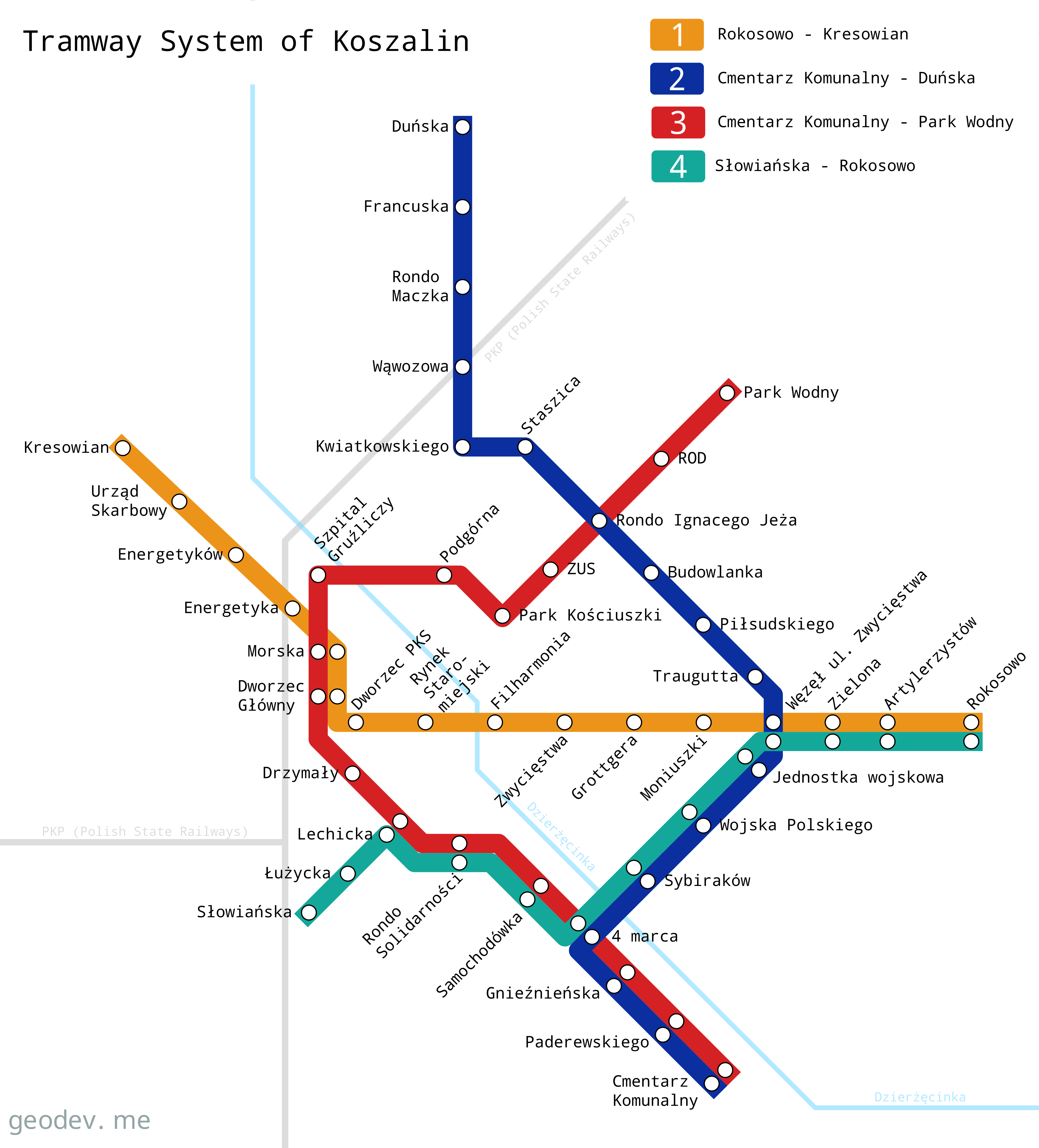
Hypothetical tramway system of Koszalin
Oct 06, 2024

Koszalin is a mid-sized city in northern Poland. It has a population of 105 000 inhabitants. Public transport is operated by MZK Koszalin (Miejski Zakład Komunikacji) and it has 19 bus lines.
This maps is my try to design a tramway system for Koszalin city. Altough Koszalin is not a big city, tramway network might enhance the city’s connectivity, sustainability, and accessibility. A tramway system would reduce traffic congestion, providing a cleaner and more efficient alternative to car travel.
My project involves the creation of four lines. All of them runs along the existing main streets of the city.
Line 1
Number of stops: 16
Length: 6.3 km
Line 1 (orange) runs east-west. Goes from the Rokosowo district along the Zwycięstwa street to the Bus Station. It runs through the main train station (PKP) and then continues north-west through the industrial area.
Line 2
Number of stops: 18
Length: 7.3 km
Line 2 (blue) runs roughly north-south. Goes from the residential area in the northern part of the city. Then goes the route number 206 and follows the 4 Marca street along the residential areas. The line ends at the cemetery on the southern edge of town, where there are also shopping malls.
Line 3
Number of stops: 17
Length: 6.7 km
Line 3 (red) starts from the eastern part to the city. The line follows national route number 6 towards the main train station. At this point it runs southeast along one of the main streets through residential areas. At some point the line overlaps with line no. 4 and heads towards the Municipal Cemetery.
Line 4
Number of stops: 13
Length: 5.4 km
Line 4 (green) operates to connect residential areas located in the southwestern and eastern parts of the city. It runs next to shopping centers and along the military unit. Its course overlaps with the other lines: red, blue and orange.